
Professional reality capture · United Kingdom
POINT CLOUD PRECISION
Every surface, captured to the millimetre.
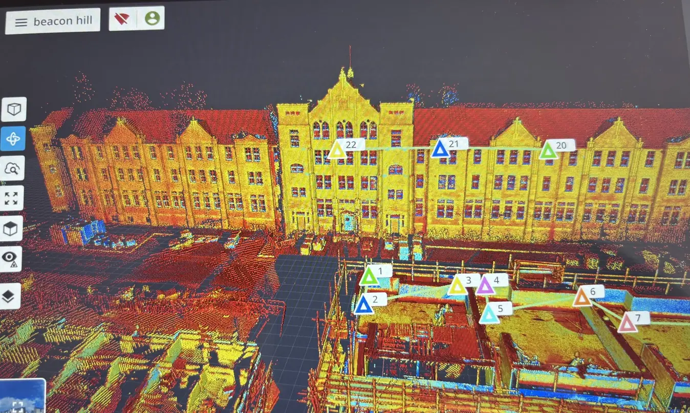
Scannix 3D Ltd delivers survey-grade laser scanning and point cloud modelling for architects, engineers and contractors — turning real-world spaces into precise, usable data.
- 2mm range accuracy
- CAD & BIM ready
- UK-wide site capture
- Scan range
- 80m
- Scan speed
- 1M pts/s
- Range accuracy
- 2mm
- Field of view
- 360°×282°
What we do
3D scanning services
Four connected services, from on-site capture through to the model your design team works in. Each can be taken on its own or as a complete package.
3D Laser Scanning
On-site 3D capture of buildings, structures and sites using the Trimble X9.
Learn morePoint Cloud Processing
Registration, clean-up and colourised point cloud deliverables.
Learn moreBIM & Reverse Engineering
Scan-to-BIM and as-built CAD modelling for design teams.
Learn moreAs-Built Surveys
Accurate measured surveys for renovation and refurbishment projects.
Learn moreWhy 3D scanning
Why architecture & construction teams choose us
Laser scanning replaces assumptions with measured data. That changes how a project is designed, coordinated and built.
Survey-grade accuracy
Millimetre-precise data you can design and build from with confidence.
Fast turnaround
On-site capture in hours, deliverables processed and returned quickly.
CAD & BIM ready
Point clouds and models delivered in the formats your team already uses.
Minimal site disruption
Non-contact scanning works around live sites and occupied buildings.
Clash detection & verification
Check as-built conditions against design intent before works begin.
One point of contact
Direct access to our team from quote through to delivery.
Industries & applications
Who we work with
We work with the teams who design, verify and build in existing environments.
Architecture
Measured records of existing buildings so design work starts from real geometry rather than legacy drawings.
Construction
As-built capture, progress records and verification of built conditions against design intent.
Engineering
Dimensionally reliable data for structural assessment, coordination and reverse engineering.
Refurbishment & Renovation
Accurate as-built surveys of occupied and live buildings, captured without contact or disruption.
How it works
From enquiry to delivered data
- 01
Discuss the requirement
Tell us the site, the scope and the deliverable you need. We confirm what is achievable and quote against it.
- 02
On-site laser scanning
We capture the building, structure or site with the Trimble X9, working around access and occupancy.
- 03
Processing & modelling
Scans are registered, cleaned and colourised, then modelled to CAD or BIM where that is part of the scope.
- 04
Delivery
Data is returned in the formats your team already uses, with one point of contact throughout.
Our equipment
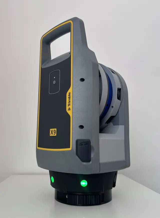
Trimble X9 3D laser scanning system
One scanner, chosen for the balance of range, speed and accuracy that architecture and construction work demands. Here is what those numbers mean on site.
- 80m
- Large facades and open sites covered from fewer positions.
- 1M pts/s
- Dense capture in hours rather than days on site.
- 2mm
- Survey-grade data you can design and build from.
- 360°×282°
- Near-complete coverage per position, fewer blind spots.
Scan range
Scan speed
Range accuracy
Field of view
Service area
3D laser scanning across the United Kingdom
Scannix 3D Ltd travels to site for laser scanning work throughout the UK, covering projects for architects, engineers and contractors wherever the building or site happens to be.
Coverage
Capture is planned around your site access and programme, so a single visit gathers everything needed for the deliverable. Tell us where the project is and we will confirm attendance and turnaround when we quote.
Request a quote
Need accurate 3D data for your next project?
Send us the site, the scope and the deliverable you need. We will confirm what is achievable and come back with a quote — one point of contact from enquiry through to delivery.